04/23/19-FIGHT AGAINST RAPID ʻŌHIʻA DEATH IS A TOP PRIORITY FOR TOURISM INDUSTRY
Posted on Apr 23, 2019 in Forestry & Wildlife, Invasive Species, sliderNews Release
| DAVID Y. IGE GOVERNOR |
SUZANNE D. CASE
CHAIRPERSON |
For Immediate News Release: April 23, 2019
FIGHT AGAINST RAPID ʻŌHIʻA DEATH IS A TOP PRIORITY FOR TOURISM INDUSTRY
Joining Forces with Land Managers & Scientists in the Battle
To view video please click on photo or view at this link: https://vimeo.com/331280910
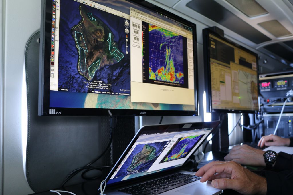
(Honolulu) – While the complete data is still being analyzed, aerial surveys of Hawai‘i Island, Kaua‘i, and parts of east Maui earlier this year covered 1,081,000 acres of ʻōhiʻa forest being potentially impacted by the serious fungal disease known as Rapid ʻŌhiʻa Death (ROD). The overflights conducted by the Arizona State University (ASU) Center for Global Discovery and Conservation Science in Hilo, utilize a high-tech turboprop aircraft loaded with sophisticated mapping and detection equipment. The $250,000 surveys were funded by the Hawai‘i Tourism Authority (HTA) as one of several ROD initiatives HTA is supporting to help educate people about Rapid ʻŌhiʻa Death and to learn more about the disease.
Kalani Ka‘anā‘anā, HTA’s Director of Hawaiian Cultural Affairs commented, “During this week of the annual Merrie Monarch Festival, it’s important for us all to be mindful of the natural and cultural significance of ʻōhiʻa lehua as our keystone native tree species for protecting Hawai‘i’s forests and watersheds. ROD is devastating hundreds of thousands of acres of native forest. Forests are life-giving in Hawai‘i in a multitude of ways. They are often the first image visitors see when flying into Hawai‘i and it’s critical we do everything possible to keep them healthy.”
Dr. Greg Asner leads the ASU team that operates the airborne observatory. This year was its third time surveying forests to collect data on symptomatic trees. Asner said, “Our January 2019 mapping update on suspected ROD trees will be coming out shortly, which will extend our total coverage of the Big Island for three consecutive years. We’ve also added parts of Maui and Kaua‘i along the way. Altogether, the mapping will continue to increase our knowledge of the rate, pattern, and overall threat level of ROD in the Hawaiian Islands. We are very proud to be working closely with DLNR, the USDA Forest Service, and all the organizations that depend on island-wide mapping results.”
DLNR and its partners conduct regular “sketch mapping” aerial surveys of ʻōhiʻa forests across the state to detect new disease outbreaks. These surveys are done from helicopters, but the data collected by ASU’s high-altitude aerial platform is much more precise and provides highly accurate location data on trees suspected to be infected with ROD.
“The HTA support has helped expand our outreach to visitors who could potentially move ROD from island to island and allowed us to utilize state-of-the art forest monitoring technologies to better map the disease,” said Rob Hauff, State Protection Forester, for the DLNR Division of Forestry and Wildlife.
Over the past year Hawai‘i Tourism has provided more than $400,000 in funding support for numerous ROD initiatives, including: $20,000 for trailhead sanitation stations and signs, $20,000 for bio-sanitation workshops for eco-tour operators, as well as support for the annual ʻŌhiʻa Love Fest in Hilo.
DLNR Chair Suzanne Case remarked, “The support from Hawai‘i Tourism is invaluable in helping get the word out about what each of us can do to help stop the spread of this insidious tree disease.”
# # #
Media Contact:
Dan Dennison
Senior Communications Manager
(808) 587-0396
[email protected]
