PLTIS Screenshots
Although the PLTIS is still under development, we have posted a few preliminary screenshots to give you an idea of what the system will look like. You may click on any of the images for a larger view.
| The PLTIS’s satellite imagery and Quick View of a Sand Island parcel: | 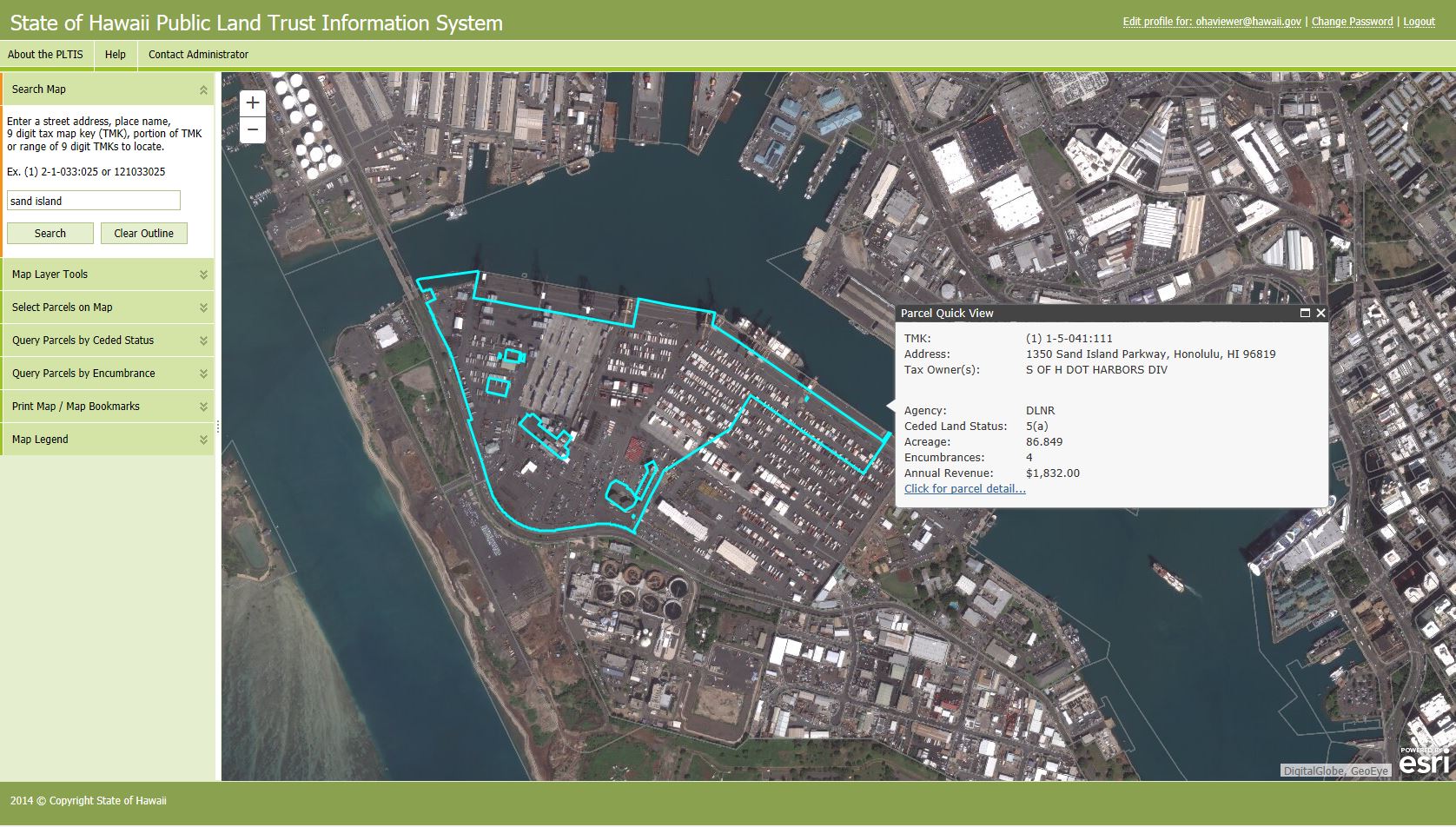 |
| Drilling down from the Quick View will display detailed information about that parcel. In this case, the details of the Sand Island parcel are displayed in the Parcel Detail view: | 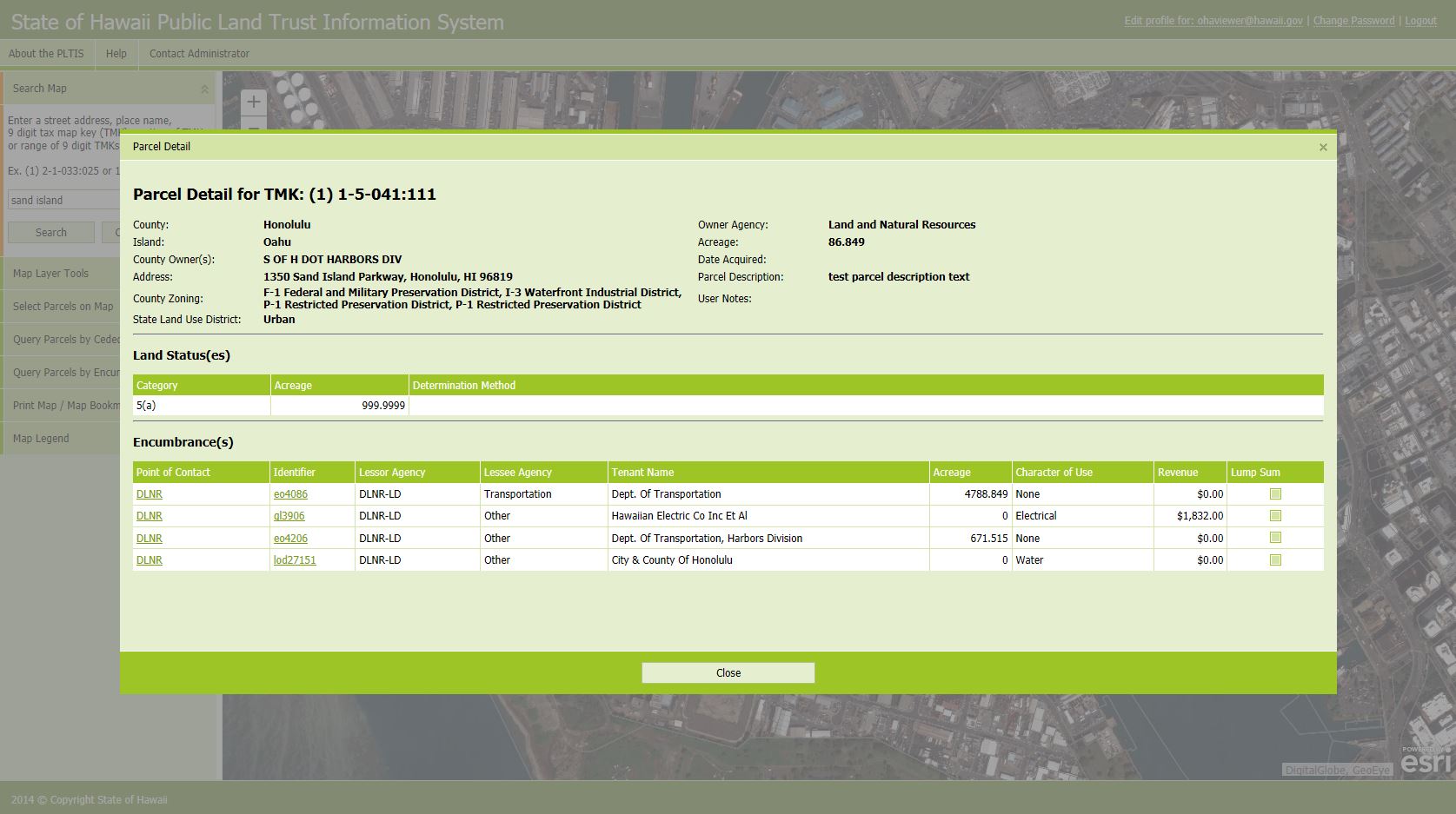 |
| Drilling down into an encumbrance will display details of the given encumbrance. In this case, the details of gl3906 are shown on the Encumbrance Detail View as a submerged land electrical easement that crosses over three parcels, including the Sand Island parcel: | 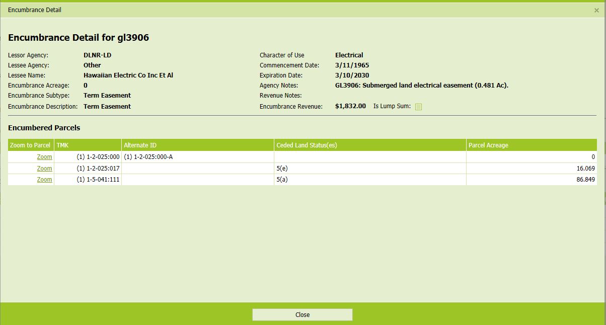 |
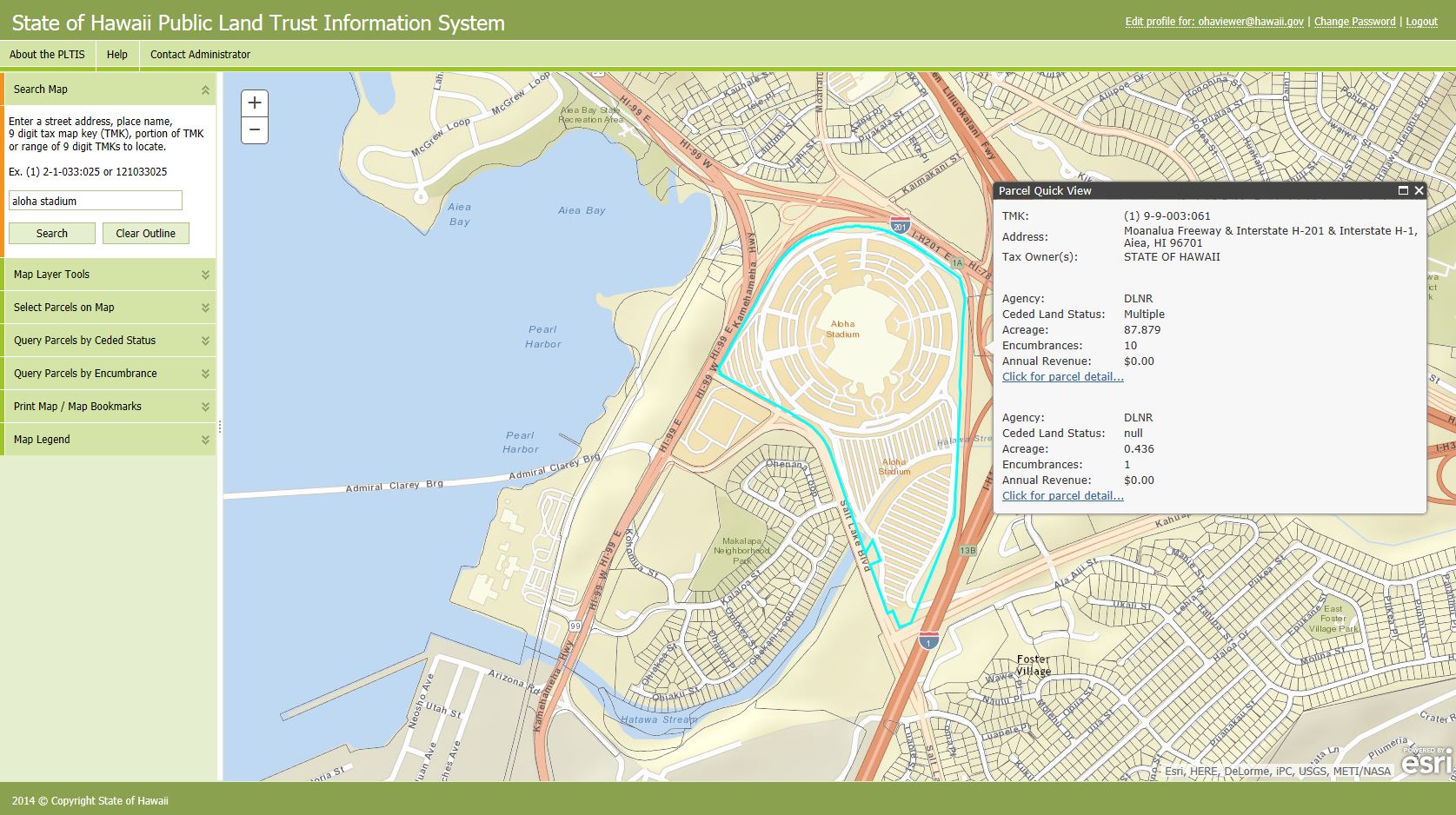
| The Aloha Stadium parcel as rendered on a street base layer |
 |
| This screenshot demonstrates the ability to search within a user-defined polygon. In this case, the criteria was DLNR properties within a user-defined polygon: | 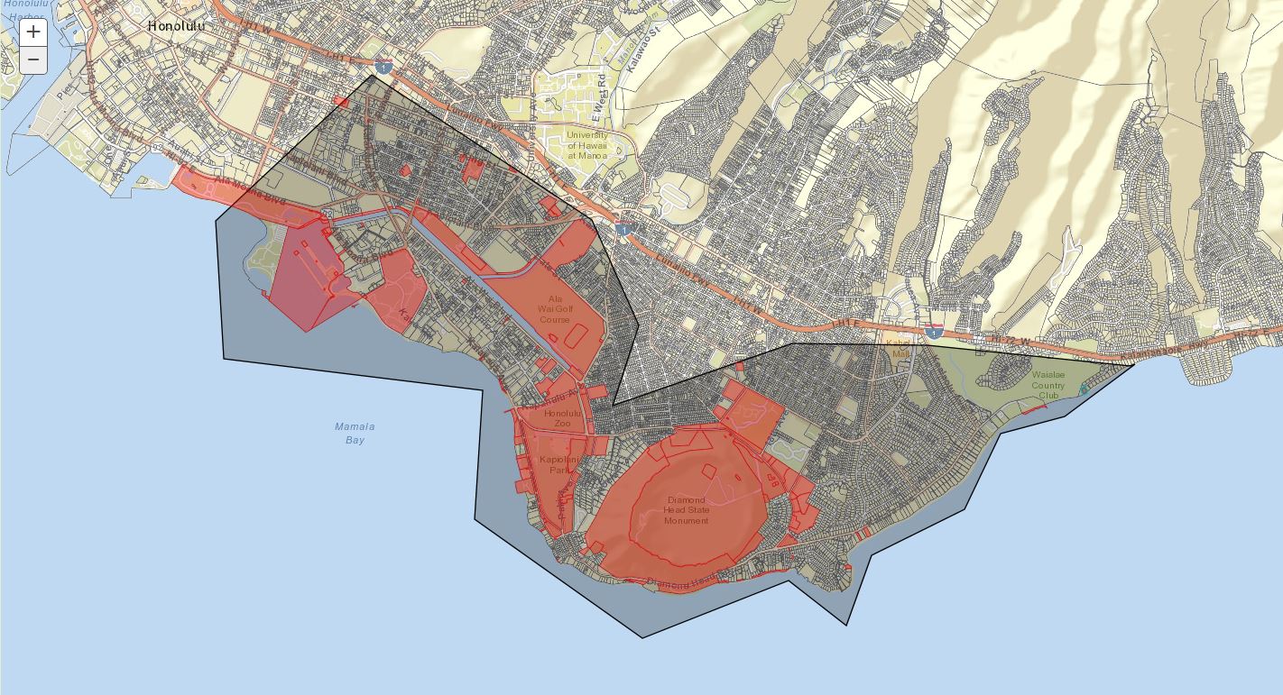 |
| A portion of Maui county, with DLNR properties rendered by Ceded Land Status: | 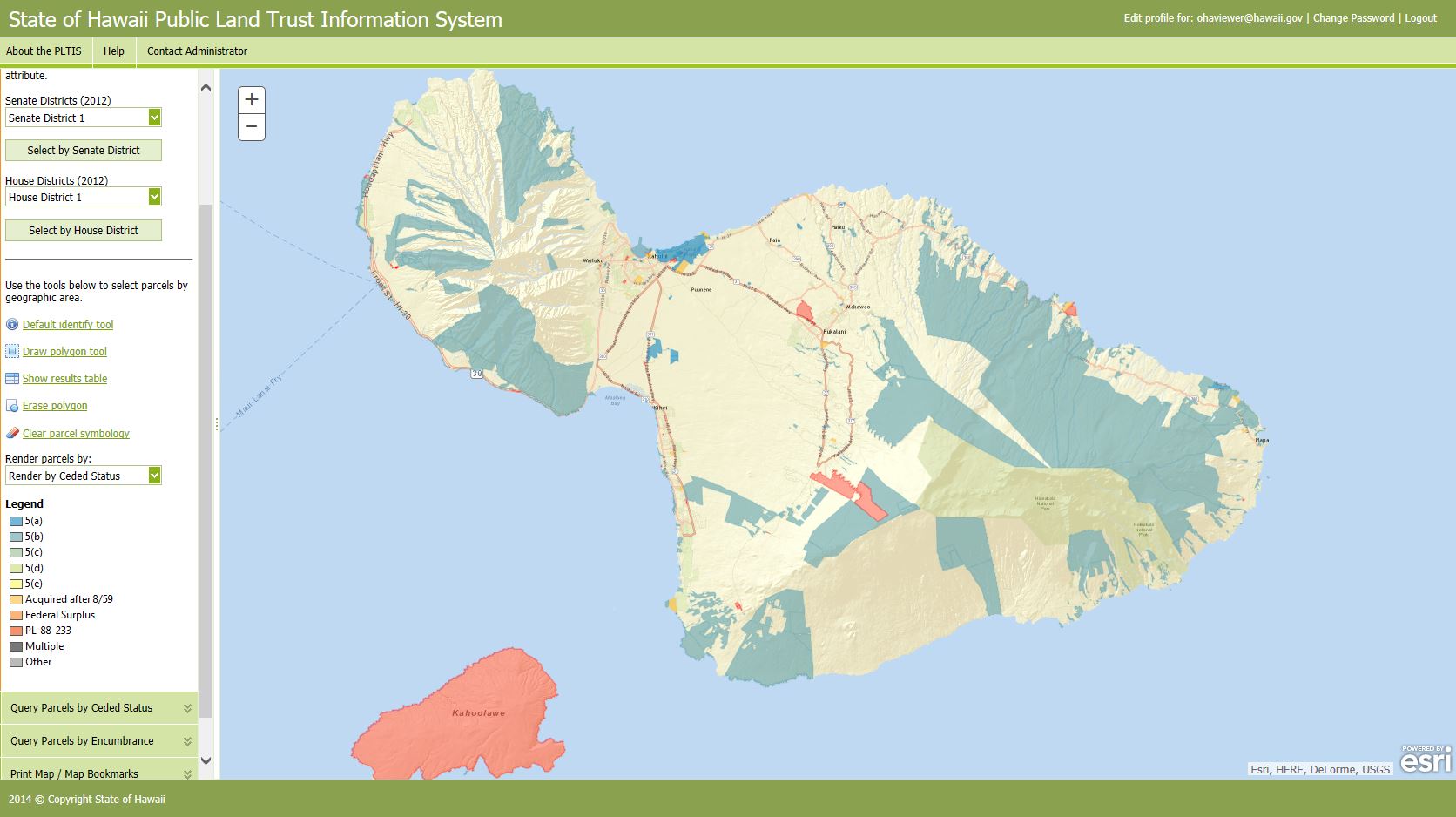 |