**IMPORTANT PARK NOTICES**
⚠️ Always monitor weather reports and ocean conditions before your park visit.
•
[O’AHU] 7/15/26 - The Royal Mausoleum State Monument, Mauna ʻAla will be closed on July 22, 2026 for crypt maintenance.
•
[MAUI] UPDATE 7/7/26
‘Iao Valley State Monument: Will be CLOSED until July 31, 2026 for safety improvements.
•
[O’AHU] 7/6/26
The Royal Mausoleum State Monument will be closed on July 7, and July 8, 2026 for John Young Tomb maintenance and repair
•
[MAUI] 7/1/26
Beginning today, July 1, 2026 through March 2027, all camper van camping reservations at Waiʻānapanapa State Park will be temporarily unavailable due to construction of the park\\\\\\\'s new comfort station.
•
[KAUA’I] UPDATE 6/23/26
The Puu Hina Hina Parking Lot remains closed due parking lot striping.
•
[MAUI] UPDATE 6/22/26
Polipoli Spring State Recreation Area: Polipoli cabins and camping areas are CLOSED until further notice.
•
[KAUA’I] UPDATED 5/27/26
Kalalau Trail from mile marker 2-11 after Hanakapiai Valley, will be CLOSED for a feral animal control hunt from June 1-4. The 2 miles of the trail from Keʻe beach at Haʻena State Park to Hanakapiai falls will remain open during this time.
—
Puʻu Hinahina parking lot will be CLOSED for road work from May 25-29 and again from June 15-19.
—
Koke’e State Park camping will be CLOSED for campground improvements. Construction to begin May 2026 and extend through Spring 2027.
—
Pāʻulaʻula State Historic Site: CLOSED for construction.
•
[O’AHU] UPDATED 6/10/26
Heʻeia State Park partial parking lot road closure due to landslide and upcoming stabilization work.
—
Wahiawā Freshwater State Recreation Area: Portions of the park which access the reservoir (Also known as Lake Wilson) will be closed Sunday, May 3, 2026 at 1 a.m. the park will remain open to visitors for onshore activities, but lake access via the boat ramp, reservoir banks, and reservoir shores will not be allowed until further notice.
—
Ka’ena Point State Park, Mākua Section has REOPENED to beach access. The Keawa’ula section remains CLOSED due to road repairs and damage due to the recent Kona Low storms. The Mokule’ia vehicle access road has REOPENED to valid permit holders - note some roads previously accessible have been closed due to storm damage - heed all road signs.
•
•
[HAWAI’I] UPDATED 4/10/26
Notice to bidders for Mobile Food Truck Concessions opened today for certain Hawai’i Island parks. More information at: https://dlnr.hawaii.gov/dsp/announcements/mobile-food-truck-concessions-hawaii/
—
Akaka Falls State Park: Water and comfort station CLOSED, park open with portable toilets.
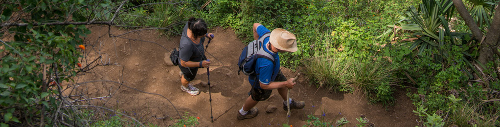
Ke Ala Loa O Maui/Piilani Trail
| Trail Length | 3 miles (round trip) |
| Activity | Pedestrian |
| Difficulty | Moderate |
| Terrain | Barren Lava, Ups and Downs. |
| Elevation Gain | 200 ft |
| Park Name | Waiʻānapanapa State Park |
Description
This is a rugged coastal trail over largely barren lava, offering spectacular views of the Hana Coast and Slopes of Haleakala, as well as stands of native hala (screwpine) trees and small offshore islets.
Route
From the State Park make your way to the shoreline at Pailoa Bay (cliff shoreline) and head southeast. The trail is obvious in some areas and less so in others, but it is easy to follow the shoreline where it is not well-marked. Be respectful of gravesites within the park area, please stay outside of these areas, indicated by low stone walls and stone platforms. Pass the park cabins and Ohala heiau (temple) inland of the trail. Continue along the rocky shoreline until you reach a boulder beach, indicating the end of the trail From this point, you can retrace your steps, or follow roads leading to the Hana Highway to return to the park. Allow at least 2 hours for the hike. You may also make a full day of it and continue along the beach to Hana Bay, where food is available and swimming is accessible.
Directions
Take Highway 360 about 53 miles (3 hours) east of Kahului airport. Waiʻānapanapa State Park is at end of Waiʻānapanapa Road.
Additional Info
- Mountain biking is not allowed on this trail.
- Stay on the trail.
- Keep dogs on leash.
- Pack out at least what you pack in.
- No open fires.
Activities
Facilities
Hazards
Prohibited
Area Weather Forecast

