**IMPORTANT PARK NOTICES**
⚠️ Always monitor weather reports and ocean conditions before your park visit.
•
[MAU’I] UPDATE 3/26/26
Waiʻānapanapa State Park : Currently CLOSED to parking, park entry, tent camping, camper van camping and all cabin reservations, anticipated REOPEN on March 31st.
-
Polipoli Spring State Recreation Area: Polipoli cabins and camping areas are CLOSED until further notice for road clearing.
-
Iao Valley State Monument: Currently CLOSED until further notice.
•
[HAWAI’I] UPDATE 3/25/26
Akaka Falls State Park: Water and comfort station CLOSED, park open with portable toilets.
-
Kiholo State Park Reserve: Road CLOSED to vehicles due to erosion until further notice, pedestrian access remains opened. Camping remains CLOSED.
-
Lapakahi State Historical Park: CLOSED until further notice due to unsafe trails and water bars.
•
[KAUAʻI] 3/24/26
Polihale State Park and camping is CLOSED until further notice due to mud and debris removal.
-
Kalalau trail OPENED.
-
Pāʻulaʻula State Historic Site: CLOSED for construction.
•
[O’AHU] UPDATE 3/23/26
Kaʻena Point State Park, Mākua-Keawaʻula Section: CLOSED due to flooding and collapsed road on Farrington Highway.
-
Kaʻena Point State Park, Mokulēʻia Section: CLOSED due to saturated and eroded roads.
-
Ahupuaʻa O Kahana State Park: CLOSED due to storm debris.
-
Puʻu o Mahuka Heiau Historical Site CLOSED due to cleanup.
•
[MOLOKAʻI] 3/23/26
Palaʻau State Wayside and camping areas CLOSED for renovations until May 4.
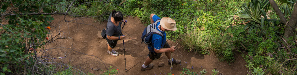
Redwood Trail
| Trail Length | 1.7 miles |
| Activity | Pedestrian, Bicycle |
| Difficulty | Moderate |
| Terrain | Mountain Forest |
| Elevation Gain | 900 ft |
| Park Name | Polipoli Spring State Recreation Area |
Route
Trail starts at Polipoli Springs State Recreation Area at 6,200′ elevation, winds through stands of redwood and other conifers, past Tie Trail junction and down to the old ranger’s cabin at 5,300′. At the trail’s end is the old Civilian Conservation Corps camp and a three-way junction, the beginning point for both the Plum Trail and the Boundary Trail. Several plum and other fruit trees can be found in this old camp area.
The Polipoli, Redwood, Plum and Haleakala Ridge Trails form a loop trail worth hiking (3.5 miles).
There are many other trails in the area, part of an extensive system administered by the State’s Trail and Access system, Nā Ala Hele.
Directions
From Kahului, take Highway 37 past Pukalani to the second junction of Highway 377. Turn left on 377 for about 0.3 mile, then right on Waipoli Road. This becomes Polipoli Access Road at the first cattle guard and climbs up the mountain through a long series of switchbacks until it enters the forest at 6,400′ elevation, where the pavement ends.
Additional Info
- Mountain biking is allowed on this trail.
- Stay on the trail.
- Keep dogs on leash.
- Pack out at least what you pack in.
- No open fires.
- Wear bright clothing.
- Be aware that you may encounter hunters who are hunting off the trail.
Activities
Facilities
Hazards
Prohibited
Area Weather Forecast

