**IMPORTANT PARK NOTICES**
⚠️ Always monitor weather reports and ocean conditions before your park visit.
•
[KAUAʻI] 3/24/26
Polihale State Park and camping is CLOSED until further notice due to mud and debris removal.
Kalalau trail OPENED.
Pāʻulaʻula State Historic Site: CLOSED for construction.
•
[O’AHU] UPDATE 3/23/26
Kaʻena Point State Park, Mākua-Keawaʻula Section: CLOSED due to flooding and collapsed road on Farrington Highway.
Kaʻena Point State Park, Mokulēʻia Section: CLOSED due to saturated and eroded roads.
Wahiawā Freshwater State Recreation Area: OPEN, boat ramp CLOSED due to maintenance.
Ahupuaʻa O Kahana State Park: CLOSED due to storm debris.
Puʻu o Mahuka Heiau Historical Site CLOSED due to cleanup.
Waʻahila Ridge State Recreation Area: CLOSED due to tree trimming.
•
[MAU’I] UPDATE 3/23/26
Waiʻānapanapa State Park : Waiʻānapanapa State Park remains CLOSED to parking, park entry, tent camping, camper van camping and all cabin reservations from Monday, March 23 through Sunday, March 29, 2026.
Polipoli Spring State Recreation Area: Polipoli cabins and camping areas are CLOSED until further notice for road clearing.
Iao Valley State Monument: CLOSED until March 30, tentative date to re-open on March 31st.
•
[MOLOKAʻI] 3/23/26
Palaʻau State Wayside and camping areas CLOSED for renovations until May 4.
•
[HAWAI’I] UPDATE 3/23/26
Kiholo State Park Reserve: Road CLOSED to vehicles due to erosion until further notice, pedestrian access remains opened. Camping remains CLOSED.
Lapakahi State Historical Park: CLOSED until further notice due to unsafe trails and water bars.
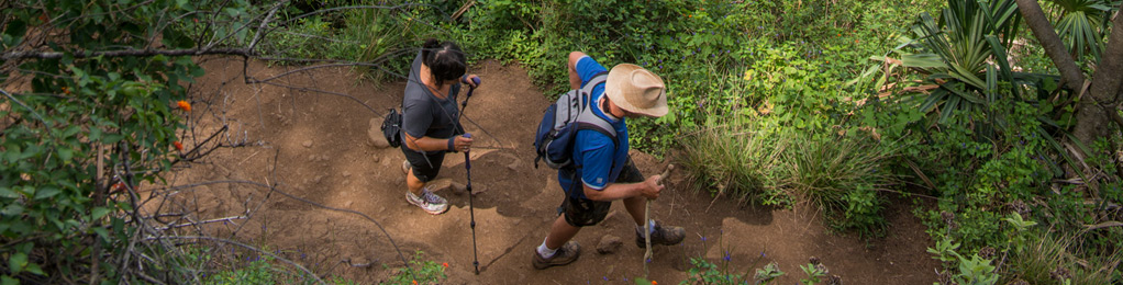
ʻAiea Loop Trail
| Trail Length | 4.8 mile loop |
| Activity | Pedestrian |
| Difficulty | Easy to Moderate |
| Terrain | Forested and Open Ridge |
| Elevation Gain | 900 ft |
| Trail Brochure | Keaīwa Heiau Brochure |
| Park Name | Keaīwa Heiau State Recreation Area |
Description
The ‘Aiea Loop Trail is 4.8-mile trail that begins and ends in the park. This trail runs along the ridge on the west side of Halawa Valley and offers views of the southern coastline of O‘ahu from Pearl Harbor (Pu‘uloa) and the Wai‘anae Range to Honolulu and Diamond Head (Le‘ahi).
Much of this area was replanted by foresters in the late 1920s. The lemon eucalyptus trees give the air a light citrus fragrance. Stands of Norfolk Island pine trees mark the lower end of the trail. Look for the native koa and ohi‘a trees as you reach Pu‘u Uau, the high point about midway along the length of the trail. You might also see remnants of a B-24 bomber that crashed in 1944.
This hike is not strenuous but involves some gradual uphill climbs with a steep switchback and a stream crossing at the end of the trail. The trail may be muddy with sections of exposed tree roots. Give yourself about 2.5 to 3 hours for the hike and enjoy the plants and the sound of birds around you.
Route
The trailhead is off the park road at the upper eastern end of the park marked by parking lots, picnic pavilions and restroom. Park your car in a marked stall and look for the trail sign. The trail will come out at the lower campgrounds. Follow the park road back to your car.
Directions
Follow H-1 to Moanalua Highway (Route 78). Take the ‘Aiea cutoff to the third traffic light, make a right turn at ‘Aiea Heights Drive and follow it about 3 miles up to the end of the road. Continue on the one-way park road to the trailhead.
Additional Info
- Mountain biking is no longer allowed on this trail.
- Stay on the trail.
- Keep dogs on leash.
- Pack out at least what you pack in.
- No open fires.
Activities
Facilities
Hazards
Prohibited
Area Weather Forecast

