**IMPORTANT PARK NOTICES**
⚠️ Always monitor weather reports and ocean conditions before your park visit.
•
[KAUAʻI] 7/8/26
The Kalalau Trail, Nāpali Coast State Wilderness Park has REOPENED.
•
[MAUI] UPDATE 7/7/26
‘Iao Valley State Monument: Will be CLOSED until July 24, 2026 for safety improvements.
•
[O’AHU] 7/6/26
The Royal Mausoleum State Monument will be closed on July 7, and July 8, 2026 for John Young Tomb maintenance and repair
•
[MAUI] 7/1/26
Beginning today, July 1, 2026 through March 2027, all camper van camping reservations at Waiʻānapanapa State Park will be temporarily unavailable due to construction of the park's new comfort station.
•
[KAUA’I] UPDATE 6/23/26
The Puu Hina Hina Parking Lot remains closed due parking lot striping.
•
[MAUI] UPDATE 6/22/26
Polipoli Spring State Recreation Area: Polipoli cabins and camping areas are CLOSED until further notice.
•
[KAUA’I] UPDATED 5/27/26
Kalalau Trail from mile marker 2-11 after Hanakapiai Valley, will be CLOSED for a feral animal control hunt from June 1-4. The 2 miles of the trail from Keʻe beach at Haʻena State Park to Hanakapiai falls will remain open during this time.
—
Puʻu Hinahina parking lot will be CLOSED for road work from May 25-29 and again from June 15-19.
—
Koke’e State Park camping will be CLOSED for campground improvements. Construction to begin May 2026 and extend through Spring 2027.
—
Pāʻulaʻula State Historic Site: CLOSED for construction.
•
[O’AHU] UPDATED 6/10/26
Heʻeia State Park partial parking lot road closure due to landslide and upcoming stabilization work.
—
Wahiawā Freshwater State Recreation Area: Portions of the park which access the reservoir (Also known as Lake Wilson) will be closed Sunday, May 3, 2026 at 1 a.m. the park will remain open to visitors for onshore activities, but lake access via the boat ramp, reservoir banks, and reservoir shores will not be allowed until further notice.
—
Ka’ena Point State Park, Mākua Section has REOPENED to beach access. The Keawa’ula section remains CLOSED due to road repairs and damage due to the recent Kona Low storms. The Mokule’ia vehicle access road has REOPENED to valid permit holders - note some roads previously accessible have been closed due to storm damage - heed all road signs.
•
•
[HAWAI’I] UPDATED 4/10/26
Notice to bidders for Mobile Food Truck Concessions opened today for certain Hawai’i Island parks. More information at: https://dlnr.hawaii.gov/dsp/announcements/mobile-food-truck-concessions-hawaii/
—
Akaka Falls State Park: Water and comfort station CLOSED, park open with portable toilets.
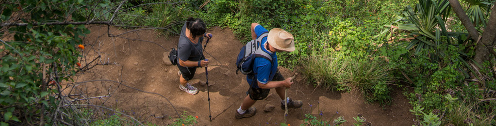
ʻUalakaʻa Trail
| Trail Length | 0.53 miles |
| Activity | Pedestrian |
| Difficulty | Easy |
| Terrain | Forested |
| Elevation Gain | 400 ft |
| Park Name | Puʻu ʻUalakaʻa State Wayside |
Route
The trail begins in Pu‘u ‘Ualaka‘a State Wayside. It is a short loop through thick forest canopy. At the uphill end of the trail you come to a 4-way intersection with Makiki Valley, Moleka, and Maunalaha Trails. There is a system trail map at this intersection. This is a good family trail.
Directions
Proceed uphill on Round Top Drive. At a hairpin turn, look for Pu‘u ‘Ualaka‘a State Wayside on the left. Drive into the State Park looking for the trailhead sign at the end of the first curve of the road. Continue up the road to the parking area, then walk back down the road to the trailhead.
Additional Info
- Mountain biking is NOT allowed on this trail.
- Stay on the trail.
- Keep dogs on leash.
- Pack out at least what you pack in.
- No open fires.
Activities
Facilities
Hazards
Prohibited
Area Weather Forecast

