StreamStats and Low-Flow Characteristics for Hawaii Streams
StreamStats is a web-based Geographic Information Systems (GIS) application for use in water resources planning and management, and in engineering design, that was developed through a cooperative effort of the U.S. Geological Survey (USGS) and ESRI, Inc. StreamStats makes the process of computing streamflow statistics for ungaged sites much faster, more accurate, and more consistent than previously used manual methods.
StreamStats also makes streamflow statistics for gaged sites available without the need to locate, obtain, and read the publications in which they were originally provided. Examples of streamflow statistics that can be provided by StreamStats include the 100-year flood, the mean annual flow, and the 7-day, 10-year low flow. Examples of basin characteristics include the drainage area, stream slope, mean annual precipitation and percentage of forested area. Basin characteristics are the physical factors that control delivery of water to a point on a stream.1
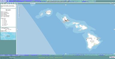
The Hawaii StreamStats was first developed in 2010 through a cooperative effort between the USGS’ Pacific Islands Water Science Center and the State of Hawaii’s Department of Transportation. Reliable estimates of the magnitude and frequency of floods are necessary for the safe and efficient design of roads, bridges, water-conveyance structures, and flood-control projects and for the management of flood plains and flood-prone areas. Hawaii StreamStats provides a simple, fast, and reproducible method to define drainage-basin characteristics and estimate the frequency and magnitude of peak discharges in Hawaii’s streams using recently developed regional regression equations.2
Hawaii StreamStats Application for Peak Flows
The Commission on Water Resource Management has faced considerable challenges in the management of surface water resources due to a lack of information on the availability of stream water during low-flow conditions. Hydrologic data, particularly low-flow conditions, is fundamental to developing reasonable and scientifically-defensible instream flow standards, along with addressing stream-related disputes and complaints. There are an estimated 376 perennial stream statewide, most of which have little to no comprehensive hydrologic data readily available. The further development of Hawaii StreamStats, to include the estimation of low-flow characteristics, will provide a more accurate, lower-cost alternative for estimating streamflow conditions at ungaged sites for the islands of Kauaʻi, Oʻahu, Molokaʻi, Maui, and Hawaiʻi.
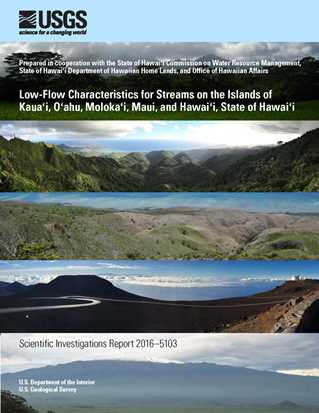
In 2013, the Commission on Water Resource Management, Department of Hawaiian Home Lands and Office of Hawaiian Affairs, entered into separate cooperative agreements with USGS to initiate Phase 1 of a Study to Estimate Low-Flow Characteristics for Streams in Hawaii. The compilation and analysis of all existing discharge measurements from the USGS National Water Information System (NWIS) database, hard copy files, and published reports (Phase 1) has been completed. The data and results of all analyses has been documented and published as USGS Scientific Investigations Report 2016-5103.
Scientific Investigations Report 2016-5103
Low-flow characteristics for streams on the Islands of Kauaʻi,
Oʻahu, Molokaʻi, Maui, and Hawaiʻi, State of Hawaiʻi (Phase 1)
The Commission is continuing to work with USGS in preparation for Phase 2 of the Study. The objective of Phase 2 is to develop methods to estimate selected natural low-flow duration discharges at ungaged sites and incorporate these methods into the web-based StreamStats application.
StreamStats Background Information
 |
November 15, 2016, CWRM Submittal A2. Request to Delegate Authority to the Chairperson to Enter into a Joint Funding Agreement with U.S. Geological Survey for the Second Phase of a Cooperative Study to Estimate Low-Flow Characteristics for Streams in Hawaiʻi. |
 |
Low-Flow Regionalization of Streams in Hawaii. USGS Pacific Islands Water Science Center Current Studies page on Phase 1 – Low-Flow Characteristics of Gaged Streams |
 |
March 20, 2013, CWRM Submittal E1. Request to Authorize the Chairperson to Enter into a Joint Funding Agreement with U.S. Geological Survey to Estimate Low-Flow Characteristics for Streams in Hawaiʻi. |
 |
March 20, 2013, Submittal E1 Briefing Materials. Estimating water availability during low-flow conditions for Hawaiian streams. By Cheng, Chui Ling. |
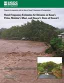 |
Scientific Investigation Report 2010-5035. Flood-Frequency Estimates for Streams on Kauaʻi, Oʻahu, Molokaʻi, and Hawaiʻi, State of Hawaiʻi. By Oki, Delwyn S.; Rosa, Sarah N.; Yeung, Chiu W. Prepared in cooperation with the State of Hawaii, Department of Transportation. |
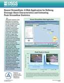 |
Fact Sheet 2010-3052. Hawaii StreamStats: A Web Application for Defining Drainage-Basin Characteristics and Estimating Peak-Streamflow Statistics. By Rosa, Sara N.; Oki, Delwyn S. Prepared in cooperation with the State of Hawaii, Department of Transportation. |
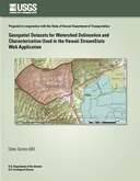 |
Data Series 680. Geospatial Datasets for Watershed Delineation and Characterization Used in the Hawaii StreamStats Web Application. By Rea, Alan; Skinner, Kenneth D. Prepared in cooperation with the State of Hawaii, Department of Transportation. |
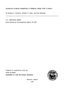 |
Water-Resources Investigations Report 92-4099. Estimation of Median Streamflows at Perennial Stream Sites in Hawaii. By Fontaine, Richard A.; Wong, Michael F.; Matsuoka, Iwao. |
1 United States Geological Survey (2016, March 1). The StreamStats Program: Application Description. Retrieved from https://water.usgs.gov/osw/streamstats/ssinfo1.html.
2 United States Geological Survey (2016, March 1). Hawaii StreamStats: A Web Application for Defining Drainage-Basin Characteristics and Estimating Peak-Streamflow Statistics. Retrieved from https://pubs.usgs.gov/fs/2010/3052/.