Kealakekua Bay MLCD
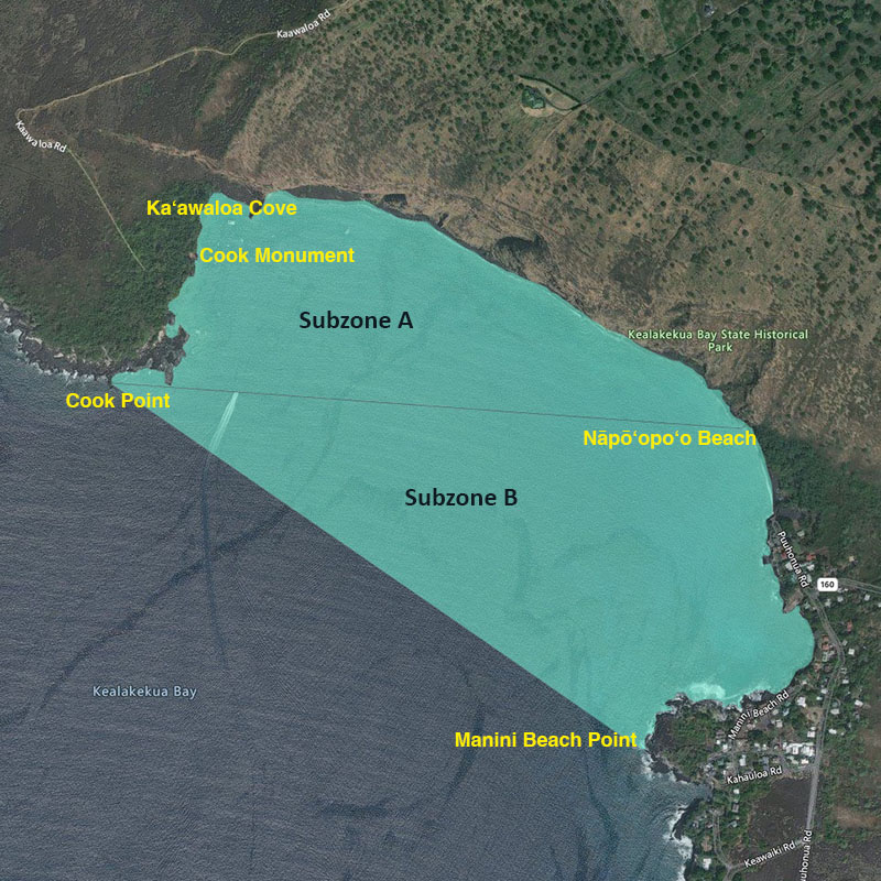
| Location | The Kealakekua Bay Marine Life Conservation District is located offshore of the Kealakekua Bay Historical State Park on the western coast of the island of Hawai‘i, from the highwater mark seaward to a line from Cook Point to Manini Beach Point. A line from Cook Point to the north end of Nāpō‘opo‘o Beach divides the District into Subzone A to the north, and Subzone B to the south. The Division of Boating and Ocean Recreation has also established provisions relating to boating, anchoring and mooring within the Marine Life Conservation District. |
| Permitted | Within Subzone B only, to fish for, take or possess any finfish with or by the use of hook-and-line and thrownet, provided that any legal fishing device or method except traps may be used for the taking of akule, ‘opelu and crustaceans. To possess in the water any knife and any shark billy, bang stick, powerhead or carbon dioxide injector. With a permit to engage in activities otherwise prohibited by law for scientific, propagation or other purposes. |
| Prohibited | To fish for, take or injure marine life (including eggs), except as indicated in “Permitted” activities above. To take or alter any sand, coral or other geological feature or specimen. To engage or attempt to engage in fish feeding. |