Water Management Areas
 Surface Water Management Areas are special areas designated by the Commission requiring users of surface water sources (such as streams, diversions, and ditches) to obtain surface water use permits to withdraw and use water for various purposes. Individual surface water management areas basically coincide with individual hydrologic units (watersheds).
The State Water Code, Chapter 174C, Hawaii Revised Statutes, authorizes the Commission to designate water management areas for surface water use regulation where the Commission, after research and investigations, and consultation with the appropriate county mayor, county council, and county water agency, and after public hearing and published notice, finds that serious disputes respecting the use of surface water resources are occurring.
View All Surface Water Hydrologic Unit Maps.
Click on the image to view or download a PDF of the Water Management Areas map.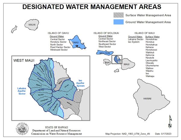
To become a designated area either the Commission or interested person must file a completed petition to initiate the designation process (View Petition for Water Management Area Action form). Various requests for government agency and public comments are an integral part of this designation process, which includes public hearings, reports, and is defined in 13-171, HAR. This process normally takes years before the Commission renders a decision.
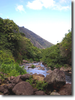
If an area becomes designated, all existing and new source owners, with the exception of individual domestic users and those on rain catchment systems, must obtain a water use permit and justify their withdrawals and uses. To justify withdrawals, source owners must meet several criteria as is listed in 13-171, HAR, to obtain a water use permit. Various requests for government agency and public comments are an integral part of this water use permit process, which is also defined in 13-171, HAR. To date, the only surface water management areas are located on the island of Maui.
For a more complete historical explanation of governmental regulation of the development and use of water throughout the state, please see the chapter of Regulation of Development and Use under the Water Resource Protection Plan of the Hawaii Water Plan.
To apply for a permit, please visit our Applications & Forms page. Should you have any questions, please contact the Commission on Water Resource Management, Stream Protection and Management Branch at (808) 587-0234.
Lahaina Aquifer Sector Area
On June 14, 2022, the Commission on Water Resource Management rendered a decision to accept the Chairperson’s recommendation to designate the Lahaina Aquifer Sector Area as both a Surface and Ground Water Management Area that includes the Honokōhau, Honolua, Honokahua, Kahana, Honokōwai, Wahikuli, Kahoma, Kaua‘ula, Launiupoko, Olowalu, and Ukumehame Surface Water Hydrologic Units and the Honokōhau, Honolua, Honokōwai, Launiupoko, Olowalu, and Ukumehame Groundwater Hydrologic Units (see map for areas affected). This decision was made in accordance with Part IV (Regulation of Water Use) of the State Water Code, Chapter 174C, Hawaii Revised Statutes, and Title 13, Chapter 171 (Designation and Regulation of Water Management Areas), Hawaii Administrative Rules.
Surface Water Use Permits (SWUP)
 Designated surface water management areas are subject to special rules to protect the water resources within given hydrologic units. The Commission has administrative control over the withdrawals and diversions of surface water within management areas.
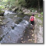
Upon designation of a surface water management area, all surface water users therein are required to obtain a Surface Water Use Permit (SWUP) from the Commission.