Kona Coast
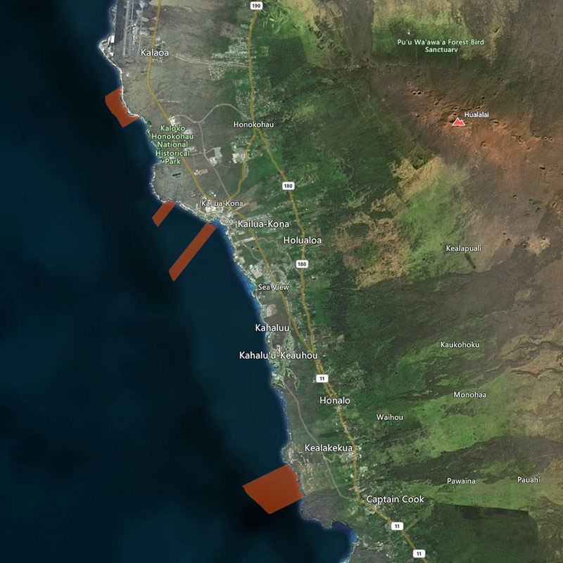
| Location | Kona Coast” refers to the following four Fisheries Management Area Zones on the southwestern portion of Hawai‘i, each bounded by two lines extending seaward at right angles from shore and marked by signs on shore: (a) the “Wawāloli Zone”, from south of Wawāloli Beach to south of Wāwahiwa‘a Point; (b) the “Papawai Bay Zone”, from Keahuolu Point to the northwestern end of the runway of the Old Kona Airport; (c) the “Kailua Bay Zone”, from Kukailimoku Point near the Kailua lighthouse, to the former swimming pool at the Kona Inn Shopping Village; and (d) the “Red Hill Zone”, from Pu‘u ‘Ōhau (“Red Hill”) to Onouli. The seaward boundary is at a depth of 100 fathoms (600 ft). |
| Permitted | To catch fish in the Zones with legal fishing gear for personal consumption. |
| Prohibited | To collect any aquarium fish within the Zones. To engage in fish feeding within the Zones, except for ‘ōpelu fishing. |