Mānele-Hulopo‘e MLCD
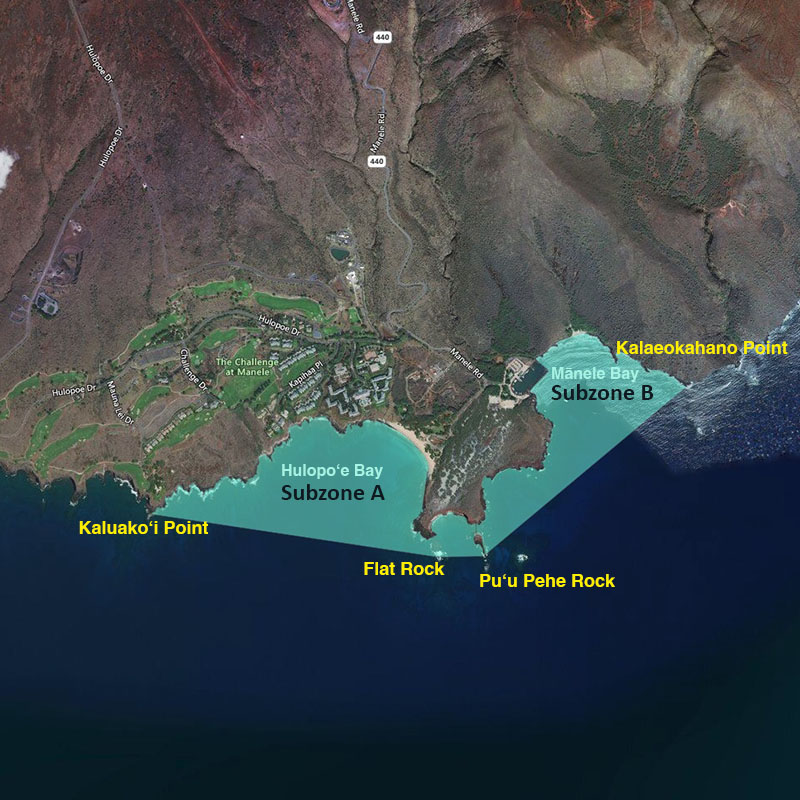
| Location | The Mānele-Hulopo‘e Marine Life Conservation District is located in the waters offshore of Palawai and Kamao on the southwestern coast of Lāna‘i. Subzone A refers to the area bounded seaward by a line from Kaluako‘i Point to Flat Rock, then to Pu‘u Pehe Rock. Subzone B refers to the area bounded seaward by a line from Pu‘u Pehe Rock to Kalaeokahano Point. The Division of Boating and Ocean Recreation has established rules relating to boating, anchoring and mooring within the Mānele-Hulopo‘e Marine Life Conservation District, as indicated. |
| Permitted | To fish for, take or possess any finfish or ‘a‘ama crab by pole-and-line from the shoreline only. To possess the following gear: pole and line, one knife, one hand net with frame no more than 3 feet in diameter (excluding handle), any legal fishing gear while on a vessel transiting to or from Mānele Boat Harbor within the harbor channel or the Harbor, but that fishing gear may not be in the water. With a permit to engage in activities otherwise prohibited by law for scientific, propagation or other purposes. |
| Prohibited | To fish for, take or injure any marine life (including eggs), or possess any fishing gear, except as indicated in permitted activities above. To take or alter any sand, coral or other geological feature or specimen. To operate, anchor or moor any vessel within Subzone A. (Manually-propelled Hawaiian outrigger canoes may be operated, but not anchored or moored, in the Subzone.) To operate, anchor or moor a vessel in such a way as to damage marine life or geological features anywhere in the MLCD. |