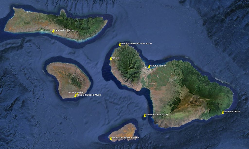
Regulated Fishing Areas in Maui County
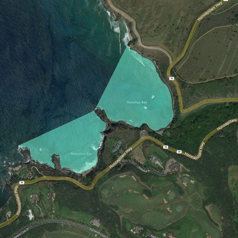
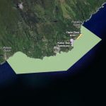
Honolua-Mokulē‘ia Bay MLCD
| Location | The Honolua-Mokulē‘ia Bay Marine Life Conservation District is located along the northwestern coast of Maui, bounded seaward by a line from ‘Alaelae Point to Kalaepiha Point, then to the point at the northeastern corner of Honolua Bay as shown. |
| Permitted | To possess aboard any boat or watercraft any legal fishing gear and fish or other aquatic life taken outside of the District. To possess in the water any knife and any shark billy, bang stick, powerhead or carbon dioxide injector. With a permit, to bag and remove akule netted outside of the District provided the net is moved only over the sandy bottom areas of the District, and to engage in activities otherwise prohibited by law for scientific, propagation or other purposes. |
| Prohibited | To fish for, take or injure any marine life (including eggs), or possess in the water any device that may be used for the taking of marine life, except as indicated in permitted activities above. To take or alter any sand, coral or other geological feature or specimen, or possess in the water any device that may be used for the taking or altering of a geological feature or specimen. |
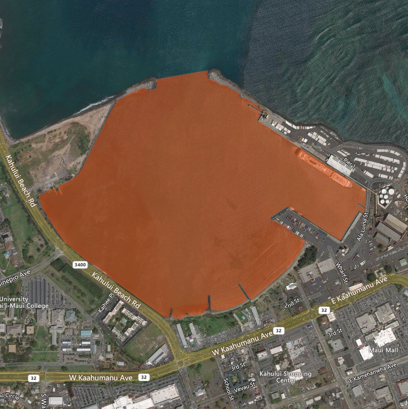
Kahului Harbor, Maui
| Location | Kahului Harbor is the primary port on the northern coast of Maui. The Fisheries Management Area is bounded seaward by a line between the seaward edges of the breakwaters, as shown. Permitted activities shall not be construed as allowing activities within any portion of the harbor which may otherwise be prohibited by laws or rules of the Department of Transportation. |
| Permitted | To use a landing net with stretched mesh of 2 inches or greater to secure hooked or otherwise detained marine life. To use a hand net while on shore to take shrimp or other marine life, provided the diameter of the net is not more than 8 inches and the handle is not more than 14 inches long. |
| Prohibited | To use any net, except as indicated in permitted activities above. To take or possess a total of more than 50 marine life per person per day. To snag any marine life. To use more than two poles with one line and up to two hooks per pole, each hook having only one point, except that double or treble hooks are allowed with lures. To take, attempt to take, or possess any marine life from the area or use any fishing gear in the area that may otherwise be prohibited. |
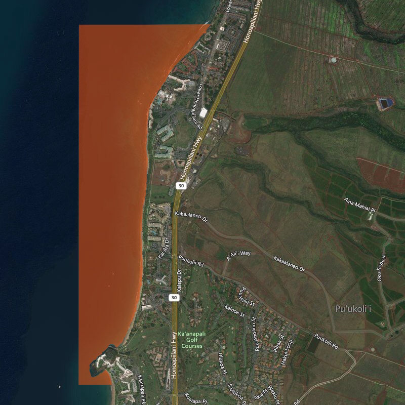
Kahekili, Maui
| Location | Kahekili Herbivore Fisheries Management Area is located off north Kā’anapali. The northern boundary is a straight line extending 1292 yards west from Honokōwai Beach Park, the southern boundary is a straight line extending 335 yards west from Hanaka’ō’ō Beach, and the seaward boundary is a straight line connecting the seaward endpoints of the northern and southern boundaries, as shown. |
| Permitted | To fish for, injure, kill, possess, or remove any finfish or invertebrate, except prohibited species indicated below. To use bait or other attractants while fishing for permitted marine life. |
| Prohibited | To injure, kill, possess, or remove any rudderfish (nenue), parrotfish (uhu), or surgeonfish. To injure, kill, possess, or remove any sea urchin. To feed or deliberately introduce any attractant, directly to or in the vicinity of any marine life, except while fishing for permitted marine life. |
Kīpahulu Community-Based Subsistence Fishing Area
| Location |
The Kīpahulu Community-Based Subsistence Fishing Area (CBSFA) is located on the southeast coast of Maui and includes the waters and submerged lands from Kālepa Gulch in the west to Pua‘alu‘u Gulch in the east, from the shoreline out to approximately 60 meters depth. It includes two sub-zones, as shown. GPS coordinates can be found in the administrative rule. Sub-zones and their boundaries (see map above): |
| Permitted |
With a permit, to take |
| Prohibited |
To take or possess |
Molokini Shoal MLCD
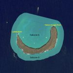
| Location | The Molokini Shoal Marine Life Conservation District is located offshore of Molokini Shoal, about three miles from the southwestern coast of Maui. “Subzone A” includes the waters and submerged lands within the crater bounded seaward by a straight line from the end of the submerged ridge extending off Lalilali Point to Pahe‘e O Lono Point. “Subzone B” includes the waters and submerged lands 100 yards seaward of Molokini Shoal and Subzone A as shown. |
| Permitted | To take or possess finfish by trolling in Subzone B only. With a permit to engage in activities otherwise prohibited by law for scientific, propagation or other purposes. To engage in commercial activities, excluding the taking of marine life, with a permit. |
| Prohibited |
To take marine life except as indicated in permitted activities above. |
Mānele-Hulopo‘e MLCD
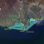
| Location | The Mānele-Hulopo‘e Marine Life Conservation District is located in the waters offshore of Palawai and Kamao on the southwestern coast of Lāna‘i. Subzone A refers to the area bounded seaward by a line from Kaluako‘i Point to Flat Rock, then to Pu‘u Pehe Rock. Subzone B refers to the area bounded seaward by a line from Pu‘u Pehe Rock to Kalaeokahano Point. The Division of Boating and Ocean Recreation has established rules relating to boating, anchoring and mooring within the Mānele-Hulopo‘e Marine Life Conservation District, as indicated. |
| Permitted | To fish for, take or possess any finfish or ‘a‘ama crab by pole-and-line from the shoreline only. To possess the following gear: pole and line, one knife, one hand net with frame no more than 3 feet in diameter (excluding handle), any legal fishing gear while on a vessel transiting to or from Mānele Boat Harbor within the harbor channel or the Harbor, but that fishing gear may not be in the water. With a permit to engage in activities otherwise prohibited by law for scientific, propagation or other purposes. |
| Prohibited | To fish for, take or injure any marine life (including eggs), or possess any fishing gear, except as indicated in permitted activities above. To take or alter any sand, coral or other geological feature or specimen. To operate, anchor or moor any vessel within Subzone A. (Manually-propelled Hawaiian outrigger canoes may be operated, but not anchored or moored, in the Subzone.) To operate, anchor or moor a vessel in such a way as to damage marine life or geological features anywhere in the MLCD. |
Mānele Harbor, Lāna’i
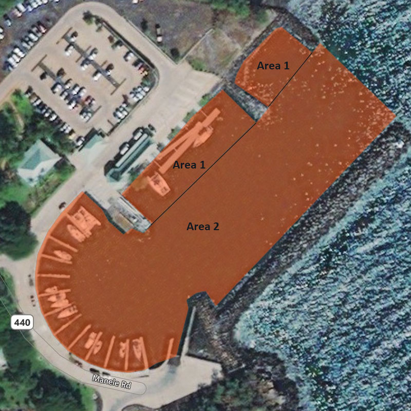
| Location | Mānele Harbor is a small boat harbor on the southern coast of Lāna‘i. Area 1 refers to the shoreline portion of the entrance channel and basin, bounded seaward by a line connecting the seaward tip of the three groins along the shoreline. Area 2 refers to the breakwater portion of the entrance channel. Permitted activities should not be construed as allowing activities within any portion of the harbor which may otherwise be prohibited by laws or rules of the Division of Boating and Ocean Recreation. |
| Permitted | To use and possess crab nets, hand nets for shrimp, and landing nets within Areas 1 and 2, provided the net’s frame is no more than 3 feet in diameter (excluding handle). To possess but not use nets on board vessels within Area 2. Commercial fishers with a Bait License may use and possess nets within Areas 1 and 2 to take baitfishes. |
| Prohibited | To use or possess any type of net within Areas 1 and 2 except as indicated in permitted activities above. |
Kaunakakai Harbor, Moloka’i
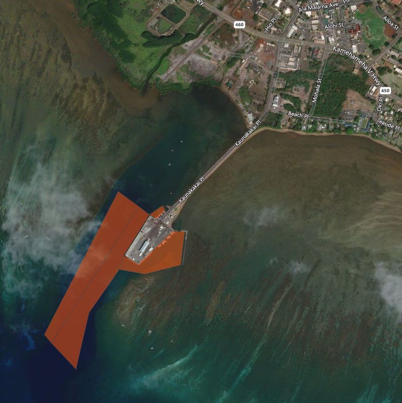
| Location | Kaunakakai Harbor is located on the southern coast of the island of Molokai. As shown in the map, portions of the commercial harbor designated “Area 1A” and “Area 1B” are separated by a line extending from the Channel Range Lights, and portions of the small craft harbor are designated “Area 2”. |
| Permitted | Within Area 1A, fishing with thrownet or pole and line; taking baitfish in season, with a bait license; and fishing with nets a) with a permit from the Board of Land and Natural Resources, b) with clearance from the Department of Transportation, and c) except at night when nets may not be set, nor remain in the water unless to complete unloading fish. Within Area 1B, fishing with thrownet or pole and line. Within Area 2, fishing with pole and line; using hand nets no longer than 3 feet in any dimension to take shrimp or land fish already hooked. |
| Prohibited | Within Area 1A, using nets except as described above; obstructing passage of vessels. Within Area 1B, using any type of net except thrownet. Within Area 2, using any type of net, except hand nets as described above. |
Kaho’olawe Island Reserve
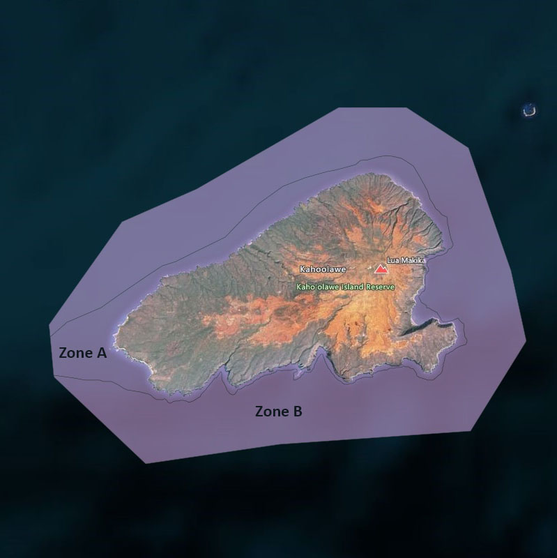
| Location | Kaho’olawe Island Reserve includes the island of Kaho’olawe and surrounding waters seaward to a distance of two nautical miles. DANGER: The Reserve is a former military range, and unexploded ordnance is present on the island and in surrounding waters. |
| Permitted | Cultural, spiritual, subsistence, preservation, restoration, educational, and fishing activities specifically authorized by the Kaho’olawe Island Reserve Commission. |
| Prohibited | All entrance into and activities within the Kaho’olawe Island Reserve, including all manner of boating, fishing, and diving, unless specifically authorized by the Commission. |
| Note | Contact the Kaho’olawe Island Reserve Commission at 586-0761 (Oahu) or 243-5889 (Maui) for assistance and further information on permitted activities. |

