Nounou and Kālepa Forest Reserves
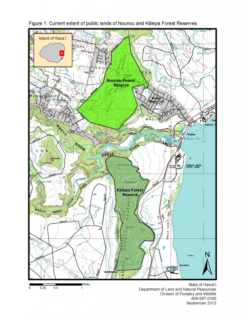
Nounou and Kālepa Forest Reserves (FR) together comprise approximately 1,393 acres of public land, and are located on the eastern side of Kaua‘i. Nounou FR lies to the north of Kālepa FR, separated by the Wailua River which is part of the Wailua River State Park.
Nounou FR was established in 1918 to protect the remaining forests, a small stream, and several springs on the leeward side of the ridge. At the time of its designation as a forest reserve, the intent was to reforest the entire ridge, to capture water from the “moisture laden wind coming off of the ocean” (Judd 1918). Kālepa Forest Reserve was established by Governor’s Proclamation in 1944, also for the purpose of reforestation. There was very severe erosion occurring on the windward side of the ridge. Currently, both reserves are generally characterized by steep, lower-mesic forested slopes. Vegetation is primarily non-native species, although there is some native vegetation in the upper areas.
Nounou and Kālepa Forest Reserves Management Plan 2015
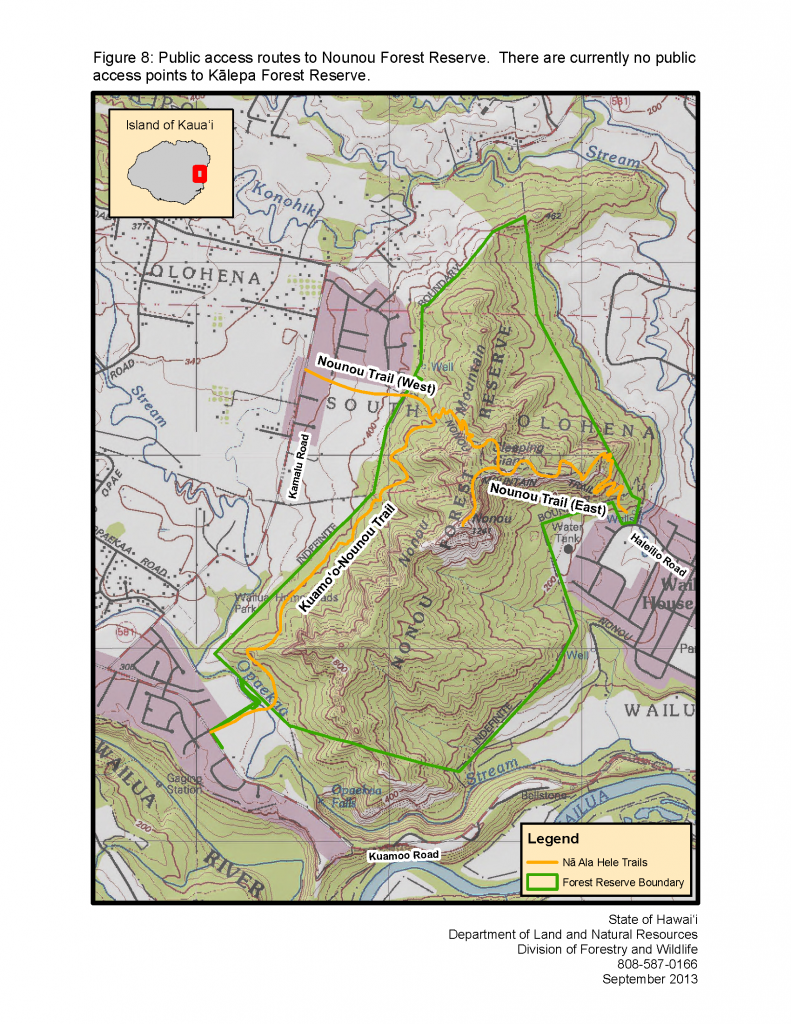
Nā Ala Hele, the State of Hawai‘i trail and access system, has three interconnecting trails that provide public access to the Nounou FR; Nounou Trail East, Nounou Trail West and the Kuamo‘o-Nounou Trail. The three trails range from easy to difficult and all are approved for pedestrian activity. Only Kuamo‘o-Nounou trail allows bicycle and equestrian activity. There are no public trails in Kālepa FR.