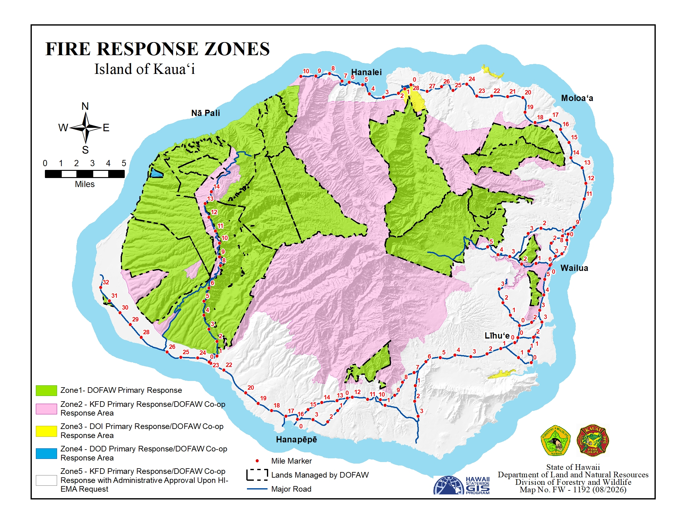
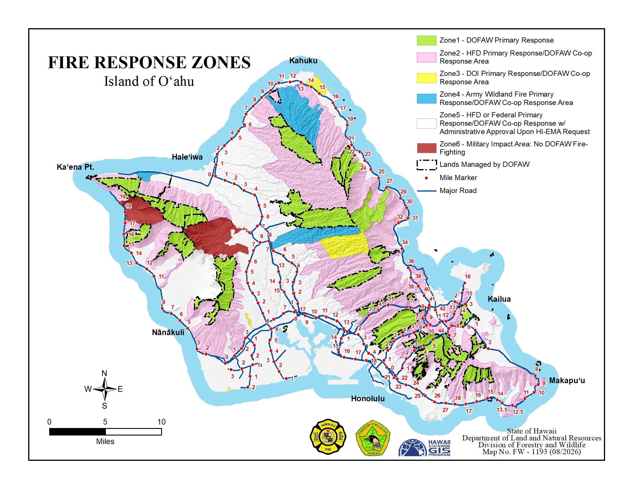
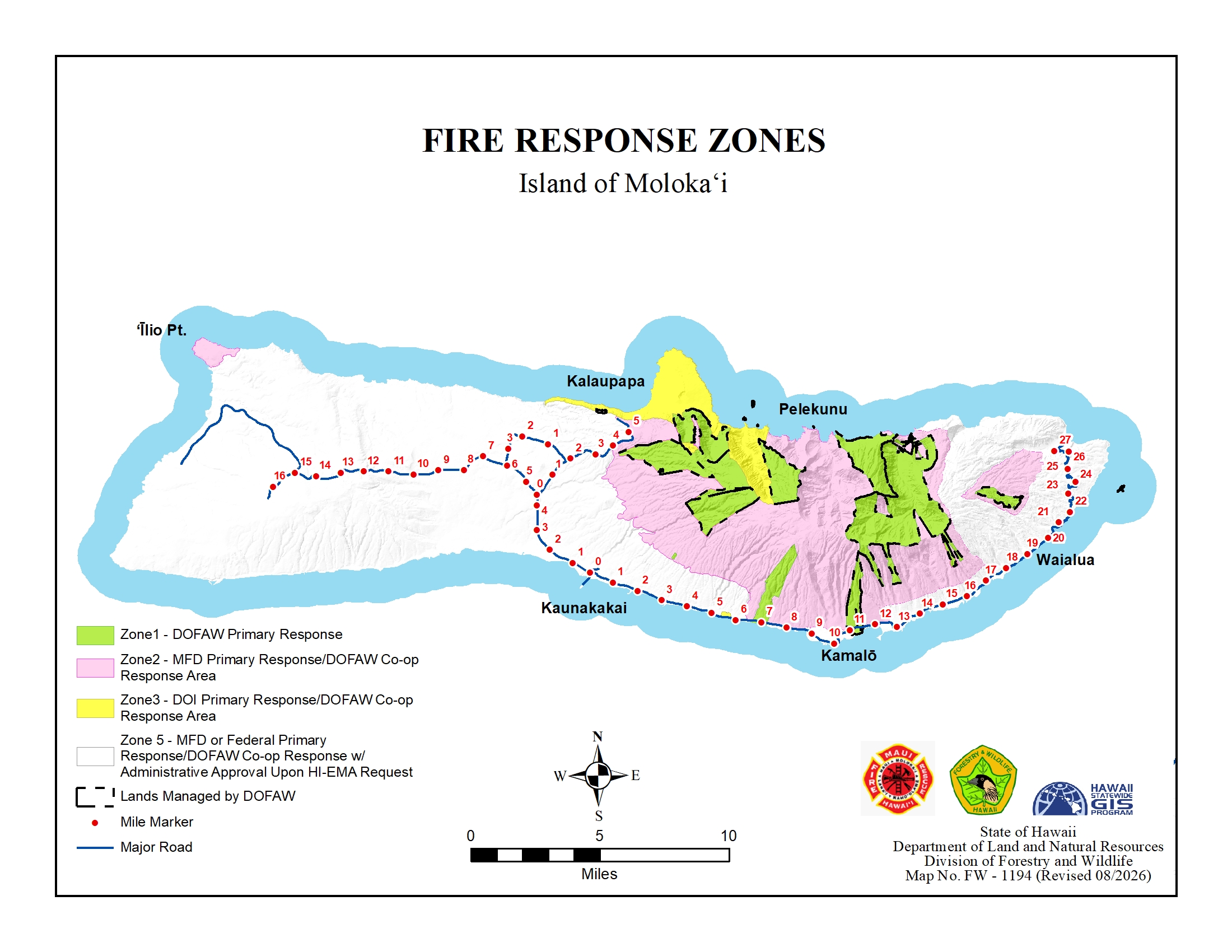
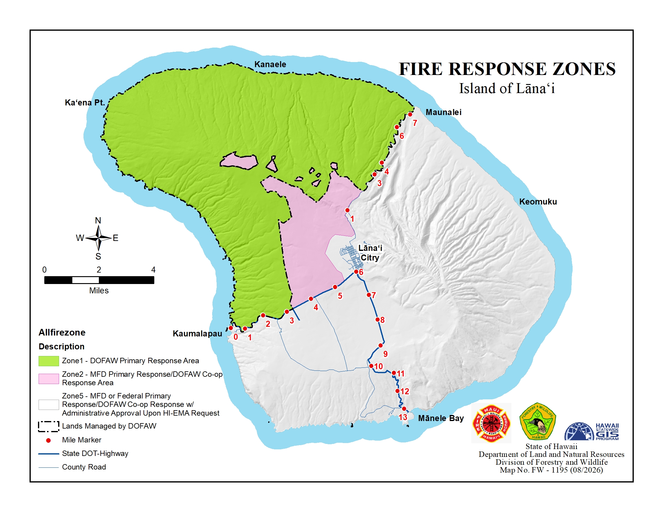
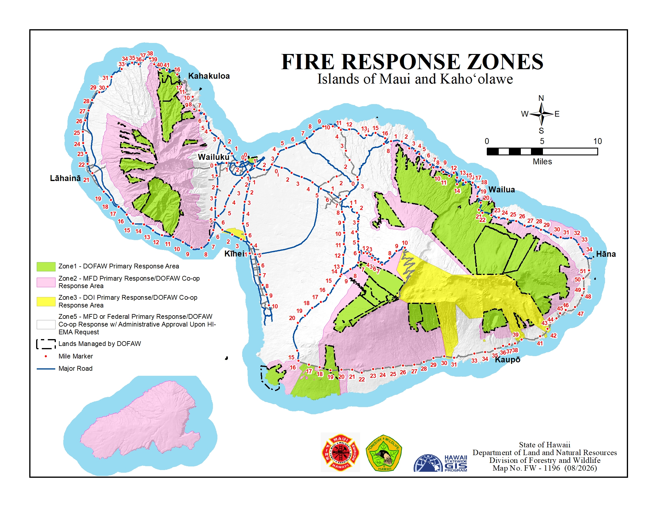
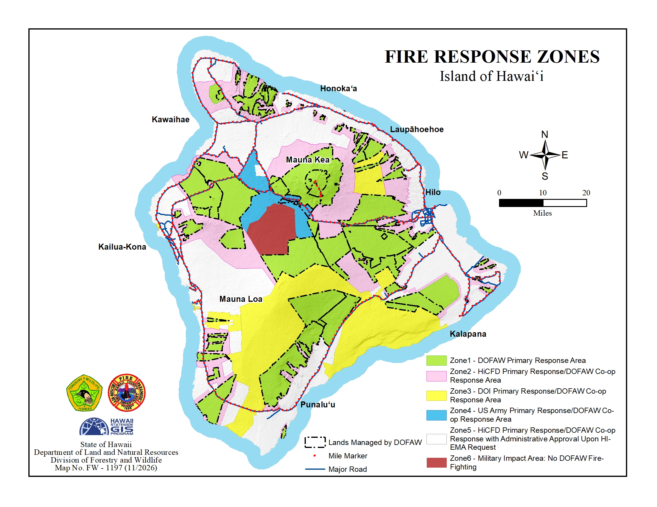
Fire Response Maps
In the early 1980s, a map of each county was delineated to depict areas where the Division of Forestry and Wildlife (DOFAW) has primary fire responsibility, areas where it could respond mutually with other firefighting agencies, and areas out of its jurisdiction (color-coded white).
It was agreed that DOFAW would be able to respond to fires in the white areas only under specific conditions, i.e. extreme threats to public safety, local resources fully committed, extreme fire behavior, etc., and through the appropriate channels and only if its resources are available. In order for DOFAW to respond to fires in the white area, the request for assistance must come from the County Civil Defense/Emergency Management Agency through the Hawaii Emergency Management Agency (HI-EMA).
Click to view fire response map for each island:
 |
 |
 |
 |
 |
 |
DOFAW Fire Management Information